
Integrated-GIS Services

Empowering our partners to better connect, communicate, and find consensus.
Canacre’s Technical Services were built from our significant expertise in complex infrastructure development, environmental, and stakeholder engagement. These experiences pointed to common challenges that hindered the successful delivery of projects and caused impasses in communications between our client and community partners. Our technical services empower our partners to better connect, communicate, and find consensus; leading to faster delivery timelines and successful projects. Visit the Mapbase website to learn more about features and integrations

Developed in-house by land professionals specifically for the management of complex infrastructure projects.
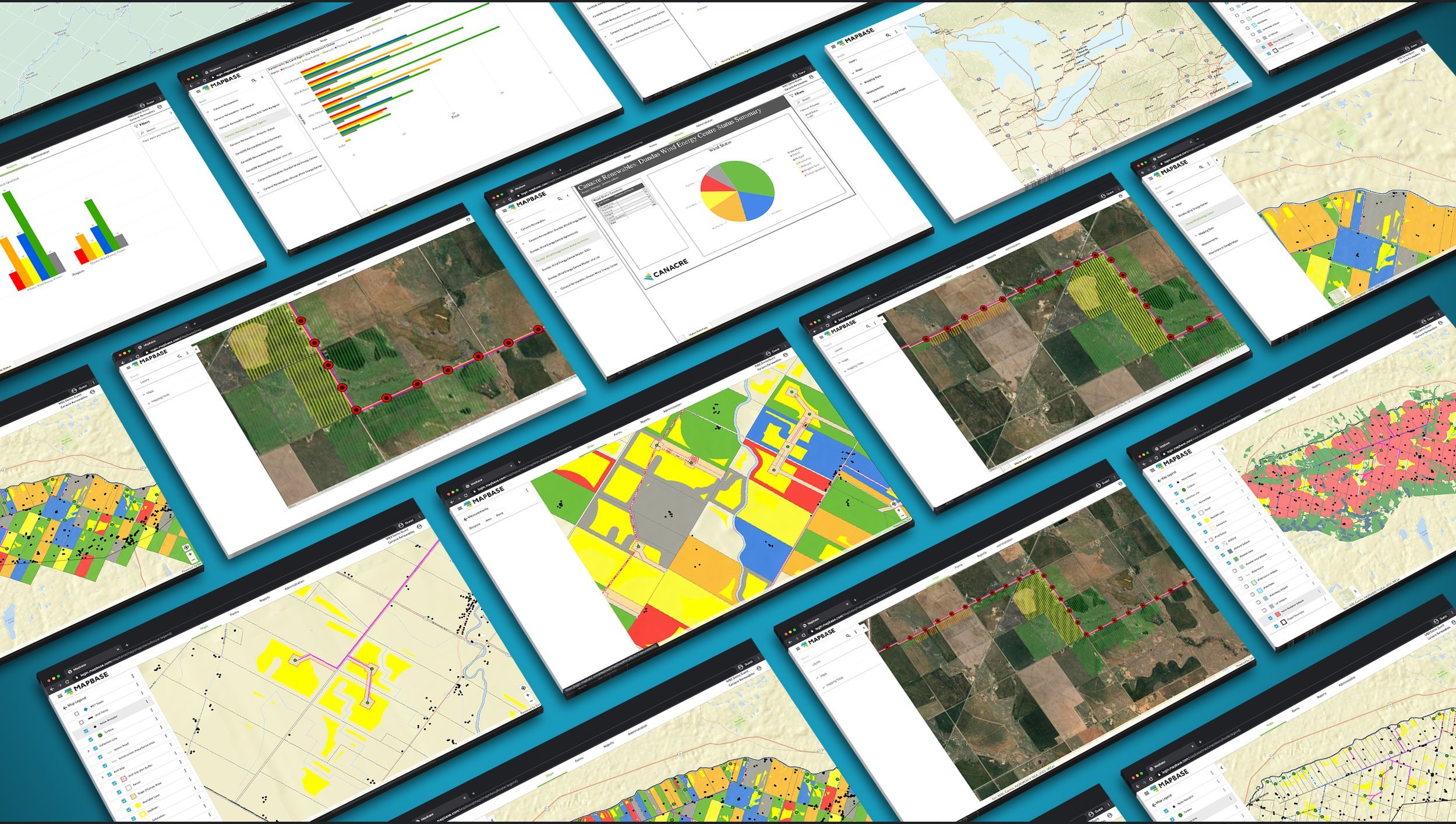
Mapbase is Canacre’s proprietary web-based interactive GIS that facilitates the management, communication and analysis of project data between our partners. Mapbase allows authorized users to easily view and download project data, acting as a central location to store project documents, shapefiles, and data.
Mapbase is used by Canacre personnel, partners, and clients to efficiently communicate land, consultation, environmental, safety, and project information across large teams. In addition, Canacre can customize reporting and data display requirements to achieve integration with our clients’ existing platforms. It serves as an integral part of Canacre’s project management approach and has consistently enabled us to achieve the milestones set by our partners and clients.
Let’s Take your Project to the Next Level.
We believe great projects start with great conversations. Book a call with us to see how Canacre can help you achieve your project goals.
(800) 645-0093 sales@canacre.com


